Mt. Shasta
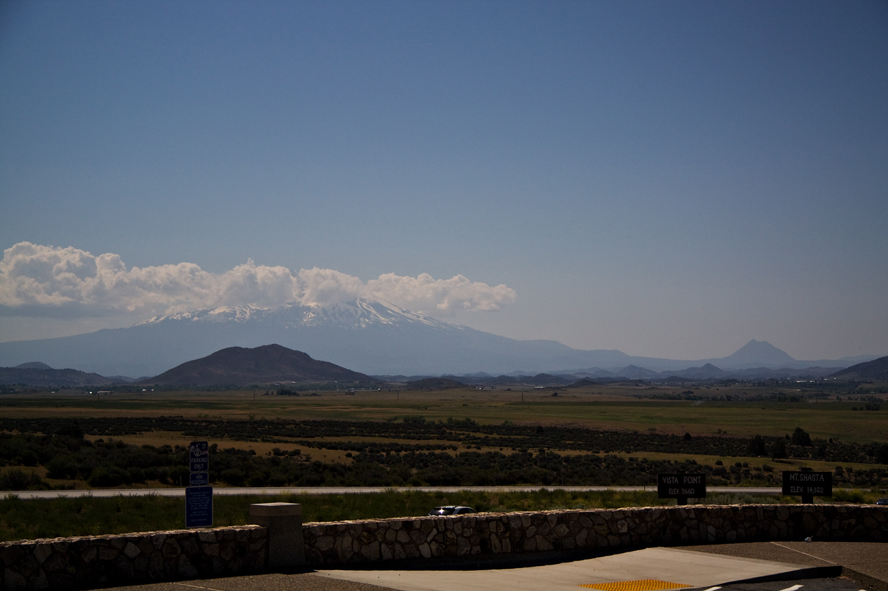
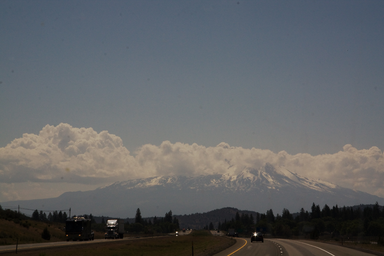
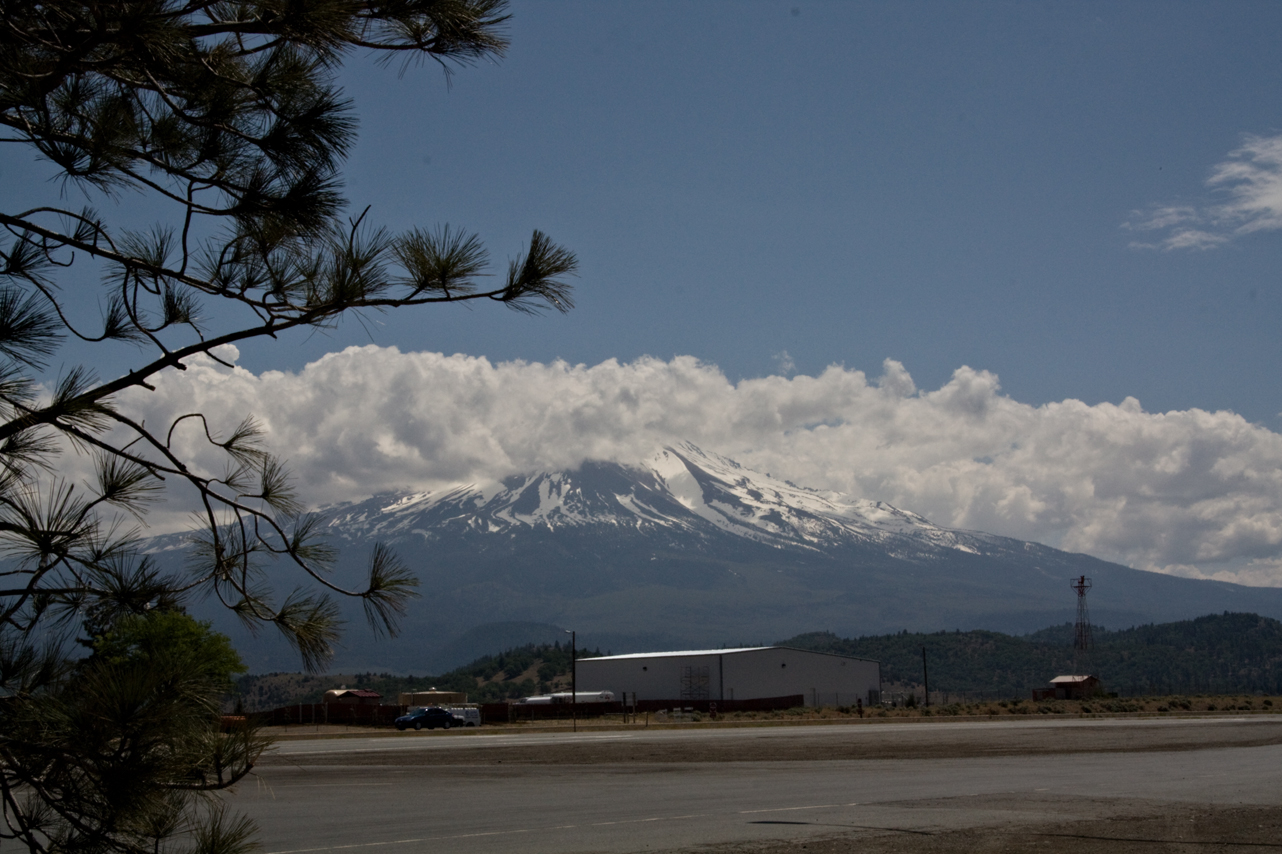
So much better “in person”…the interstate wraps around Mt. Shasta – it goes from a distant mountain to an “in your face” majestic, snow covered, volcanic peak. 14000 feet plus.

So much better “in person”…the interstate wraps around Mt. Shasta – it goes from a distant mountain to an “in your face” majestic, snow covered, volcanic peak. 14000 feet plus.
Bob had an outing. Karl and I had a nice long walk. It cooled off to 53 overnight. Overcast this morning but I believe forecast is for clearing. In deference to Sunday and a full and quiet park, we are delaying leave-taking until 7:00 a.m. – the end of quiet time.
I’m looking forward to today – hope to stop for a bit somewhere near Mt. Shasta and enjoy the cool. Our route today is I-5 until near Sacramento when we pick up I-505 into Vacaville.
8:20 First rest stop – finally cleared the overcast into hazy sunshine. Forgot in previous posts – the lupins are blooming along the highway along with something gold – very pretty with the lush green. When I got fuel this morning – an oh, in OR you may not pump your own…darn!! – 2 people attended me and they had questions about my travel so we had a nice chat AND they cleaned my windshield!!! – I LOVE OR! The young woman reminded me that the reason OR is so green is all of the rain. She and her family had moved from AZ – she said it took awhile to get used to the rain.
Ok – warming some coffee, making a breakfast burrito, will take a quick walk with Karl and off we will go.
10:00 a.m. Medford, OR. Engine Service light on and reduced engine power. Pulled over, stopped and restarted – all ok. I forgot to check the gas cap after someone else refueled which I know better! I’m suspecting that might be the issue, causing that vacuum thing that happens when the gas cap does not get seated correctly. Have reseated and will continue. Anyone with a GM engine that knows the sequence for turning off the engine service light, please send it on – comments or email: ann at beardogco dot com. I couldn’t find it in my manual and won’t be able to get anyone today or tomorrow. I’d like to reset and then see if it comes on again. I have it somewhere but can’t think where at the moment…
11:45 never mind – Google!!! – I found it and all is reset and I had no problems in the last 1 hour 45 – even over 2 mountain passes including Siskiyou. Hopefully just the gas cap. I’m stopped at a rest stop in the shadow of Mt. Shasta. Had lunch. Karl and I will walk and take some photos before getting back on the road. About 71 – very hazy but not overcast.
3:45 last rest stop after fuel stop. All still ok. In Willows, CA about 90 miles out. Hope to be in Vacaville plugged in 6-6:30 latest.
6:00 p.m. arrived Vacaville. No dramas, all well, just tired and hot. More later
Yesterday’s drive was absolutely beautiful. The interstate hugs the shore of the Columbia gorge with wonderful views of the rushing water, barges, boaters and some lush looking vineyards. There are nice RV parks, state parks and camping areas (motels also) along the way and this area would be on my list to spend more time. It was the perfect temperature at 68. Occasionally a bit of wind but nothing too bad.
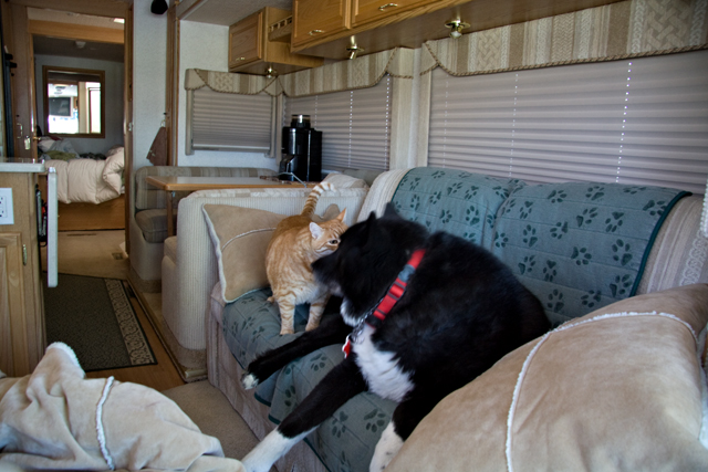
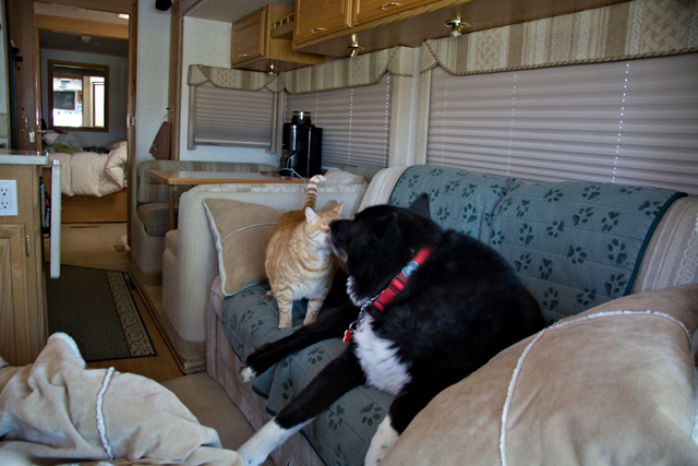
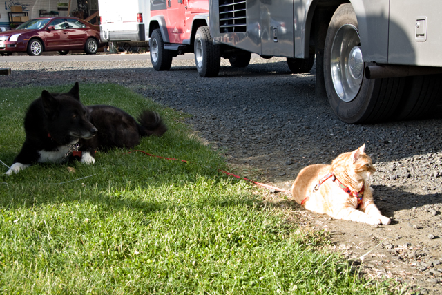
Bob and Karl shared a moment as I got situated at a rest stop. Karl rides on the couch behind the driver seat, Bob on the recliner across from him. On occasion they have shared the couch while underway, but typically, they like their own space!
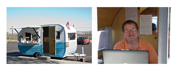
No espresso, but a “safety” coffee trailer manned by husband and wife. I had coffee, was kind of hoping for donuts but cookies were the order of the day. I neglected to ask for names but had a nice chat and got some great info for returning. One thing we had passed was groves of cedar trees – I finally saw a sign that said cedar wood trees. They were fairly obviously planted “forests” – come to find out, they are for pulp and the locals call them toilet paper trees :)!
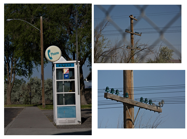
And a couple of blasts from the past – I was so surprised to see a phone booth that I had to take a photo – apparently it is currently an oft photographed item. Less photographed and coffee couple laughed with me, are the glass insulators – still apparently in working order!
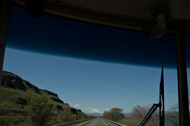
I am not having a lot of luck with my windshield photos this trip. But, I had to try for Mt. Hood. I was completely surprised to round a corner and there he was. Mt. Hood is over 11,000 and standing there all by his self. Looks a bit small and lost in this photo, but trust me, it was spectacular to see!
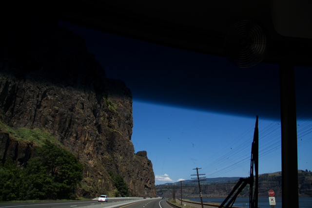
The gorge…too tired to disappear the bugs…
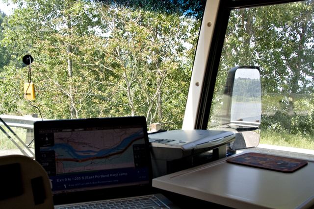
You can see more of the gorge in my mirror, but I confess I was mostly shooting the GPS display. This is my first trip with the new version of Delorme Street Atlas and this is the best. All the good info is large and easy to read – on the left is miles until the next turn, miles to go and ETA. On the bottom is detail about the next turn including things like “stay in the left lane on the ramp”. This is the tool that makes it easy to do this on my own. Between the text and voice guidance, it is almost like having a co-pilot…neither Bob nor Karl like to look at a map… Anyway, am loving this latest version. San Fran will NOT beat us!
We all enjoyed a bit of relaxing outside before dinner. Another great day!